Navigating the Gulf Intracoastal Waterway and the Florida portion of the Great Loop.
Story & photos by Tom & Brenda Lahey
After traversing the river system and reaching the Gulf in Mobile, Alabama, the Great Loop route joins the Gulf Intracoastal Waterway (GIWW) at the southern end of Mobile Bay. Most Loopers will take a left turn and head toward the Florida Panhandle. For those with a bit of extra time, you can head west on the GIWW to visit Gulfport, Mississippi, and New Orleans is just 130 miles away. It’s an excellent side trip!
The Panhandle
Many Loopers end up in the Panhandle in the period between Thanksgiving and Christmas. Usually, the weather is still pretty warm, and there are plenty of places to explore. Just after Mobile Bay, Gulf Shores (the home of LuLu’s, Jimmy Buffett’s sister’s restaurant) and Orange Beach (The Wharf Complex) both have great marinas. Also, there are two large boatyards in this area.
When you cross into Florida, you can visit Pensacola, home of the Naval Air Station and Blue Angels. There is an excellent air museum on base, with a marina nearby in downtown. After Pensacola, the route becomes less populated, with popular stops being Fort Walton Beach and Destin. From Destin, you enter the Choctawatchee Bay, a large open stretch of water, followed by 20 miles of narrow dug canal through pine barrens that connects to West Bay. This is an area with no marinas and few anchoring opportunities until you reach Panama City and Bay Point, with lots of marinas to choose from. Both are popular Looper stops.
After Panama City, you again enter another large bay with little to offer, and another 25-mile narrow stretch of the GIWW that is mostly pine barrens with limited anchoring and no marinas. The stretch from Panama City to Apalachicola is 60 miles.
Be cautious on this entire section from Port St. Joe to Apalachicola, as there is quite a bit of commercial barge traffic that can be tricky to pass in the narrow sections.
The Gulf crossing
Once in Apalachicola, you will need to start planning your Gulf crossing route and begin watching for a weather window. Apalachicola is technically the end of the GIWW. From there, you enter Apalachicola Bay, and while there are some barrier islands, you are technically in open Gulf waters. Some Loopers will begin their crossing from Apalachicola. Most, however, continue to Carrabelle to wait for their opportunity to cross the Gulf. There are several marinas in Carrabelle and lots of resources.
When crossing the Gulf, Loopers typically follow one of two routes. The first goes straight across the Gulf from Carabelle to Tarpon Springs or Clearwater. This route is around 170 miles. Faster boats (15 knots plus) can do this during daylight hours by leaving as soon as it starts getting light and arriving in the late afternoon. Slower boats typically will leave Carabelle at 2 to 3 p.m., cruise overnight, and arrive in Tarpon Springs in the late afternoon the next day.
The second route is the Big Bend Route. This leaves Carabelle and goes to Steinhatchee, about 80 miles away, which is home to two large marinas and a great anchorage. From Steinhatchee, it’s a 48-mile hop to Cedar Key, a 75-mile hop to Crystal River, or a 115-mile direct hop to Tarpon Springs. Those choosing to visit Cedar Key or Crystal River should check the depths, as these locations may not be suitable for deep-draft boats.
Regardless of which route you choose, check the AGLCA Forum and the “Go-Or-No-Go” discussions, as well as chatting with other Loopers. Most Loopers will buddy up and form a flotilla for the crossing, both for safety and moral support!
Florida’s Gulf Coast
Once you reach Tarpon Springs (a great stop with lovely Greek food and the Sponge Museum), you are back in the protected waters of the GIWW for most of your trip down the west coast of Florida. There are lots of marinas, anchorages and mooring fields to choose from, all the way to Fort Myers Beach, where the GIWW ends.
Popular stops along Florida’s West Coast include Clearwater, St. Petersburg, Tampa, Bradenton, Sarasota, Boca Grande, Captiva Island, Cape Coral and Sanibel. There are many small marinas and excellent anchorages all along the barrier islands. You will want to study your Waterway Guides to plan your stops.
The outer islands along the Gulf Coast offer many anchoring opportunities and beautiful shell-covered beaches to explore. Pelican Bay at Cayo Costa State Park is a very popular Looper anchorage with dinghy access to the park.
The Keys vs. Lake Okeechobee
As you near Fort Myers Beach, you will again need to make a major route decision. Do you continue south in the Gulf to the Florida Keys, or do you turn up the Caloosahatchee River to Fort Myers and take the Lake Okeechobee route?
The Okeechobee Waterway: Taking Lake Okeechobee cuts off about 400 miles around the Keys. It also bypasses the heavily congested and somewhat expensive areas around Miami, Fort Lauderdale and Palm Beach. The distance from Fort Myers to Stuart is about 150 miles. There are five locks that you will need to traverse, which are small and have limited commercial traffic. Typically, the Okeechobee route takes between two and five days, depending on your speed. There are good marinas and anchorages along the route. Note that anchoring in Lake Okeechobee is not recommended. Also, the locks close early (around 4 p.m.).
One final consideration is your boat’s draft. The lake is very shallow in some areas, and due to recent droughts in Florida, its depth has been significantly reduced. Most Loopers take the route straight across the lake rather than the “Rim Route,” as the water is deeper and the trip is shorter. Some locks on the Rim Route have been closed due to low lake levels.
The Keys: If visiting the Keys is in your plan, you will continue South into the Gulf from Fort Myers Beach, past Naples and Marco Island (both great stops!). After Marco Island, the next stop for most Loopers is Marathon, 95 miles away. Marathon is Looper Central, with many boaters spending the winter there. There are many marinas, anchorages and mooring fields to choose from. From Marathon, you can get to Key West, 45 miles away, either by boat or by bus for $1!
If Key West is in your plans, check marina availability and price. It can be very expensive. An alternative is to stay in Stock Island, on the north end of Key West, which has more economical marinas and provides shuttle service to downtown.
From Marathon, there are two options for heading north. If you have a shallow draft, you can take the more protected inside route along the Atlantic ICW; if not, take the outside route. Both routes offer many marina and anchorage options all the way to Biscayne Bay and Miami.
Florida’s east coast
Miami, Fort Lauderdale (The Yachting Capital of the World) and the Palm Beach area offer lots to see and do, from Little Havana in Miami to Mar-a-Lago in Palm Beach. There are many marinas, some of the best boatyards, but limited anchoring opportunities. Also, you will find that marina prices in this area are among the most expensive on the Loop. There are some excellent and more economical marinas; you just have to do some research and use your BoatUS or Dockwa discounts. Traffic in this part of Florida, especially on weekends, can be very heavy in the ICW, and there seems to be a drawbridge about every 2 to 3 miles. There are many inlets that allow you to jump outside in good weather and skip some of the chaos!
Once past Palm Beach and into the Stuart area (where the Okeechobee Waterway rejoins the ICW), the ICW becomes less busy, the channels are wider, and there are more anchoring opportunities and economical marinas.
Traveling up Florida’s east coast, there are some great stops along they way, including Fort Pierce, Vero Beach, Melbourne, Titusville (where you get the best view of rocket launches from Cape Canaveral), Daytona Beach, Palm Coast (our home port), St. Augustine (America’s Oldest City), and Jacksonville, where you can take a side trip up the St. Johns River (the river flows from south to north!) to Sanford, just 20 miles from Disney.
After Jacksonville, you are just 25 miles from Fernandina Beach, with its excellent marinas, and the crossing into Georgia. Some Loopers choose to go outside and skip Georgia. We have found it to be one of the most beautiful, undeveloped sections of the Loop. But that’s a story for our next installment!
The GIWW and Florida offer an opportunity to slow down after the hectic pace of the rivers. Loopers can find a marina to stop and relax, choose to winter in the Florida Keys, or leave their boat at a marina to head home for the holidays.
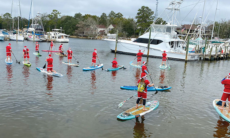
Top image: New Year’s Day Santa Paddle, Niceville, FL
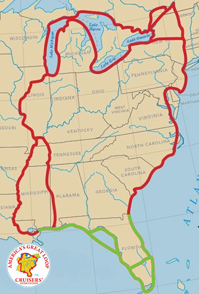
The Gulf and Florida route, highlighted in green
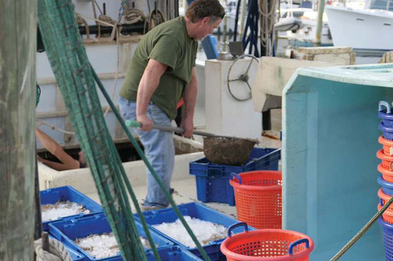
Fresh shrimp right off the boat, Dog River Marina, Mobile, AL
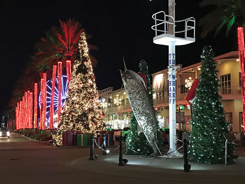
Christmas at The Wharf, Orange Beach, AL
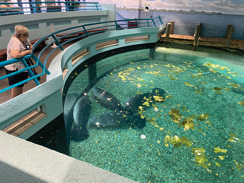
Manatee Hospital, Bradenton, FL
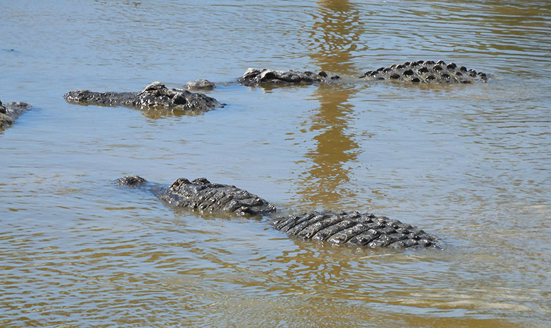
Yes, there are gators! Everglades City, FL
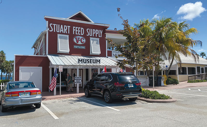
Stuart Feed Supply Museum, Stuart, FL
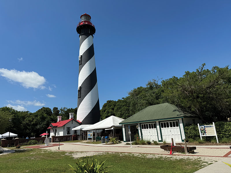
St. Augustine Lighthouse, St. Augustine, FL