
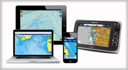
Know exactly what’s under the water’s surface with Navionics’ SonarChart and SonarChart Live — high-definition bathymetric systems available on plotters and mobile. Used together, the SonarChart and SonarChart Live provide an incredible amount of up-to-date bathymetric detail.
The SonarChart is a 1-foot, high-definition, constantly-updated bathymetry map. Boaters can gain a better awareness of shallow areas and fishing spots thanks to the maps’ bottom contour detail. The SonarChart works due to SonarChart Live, which allows users to create personal 1-foot HD bathymetry maps that display in real time while navigating. These logs can then be uploaded to Navionics from all major plotter/sonar brands and mobile devices. When boaters upload sonar logs to SonarChart’s existing data, it makes their maps more accurate. This updated data is available to all on plotter, mobile and online.
For more information, visit navionics.com.