
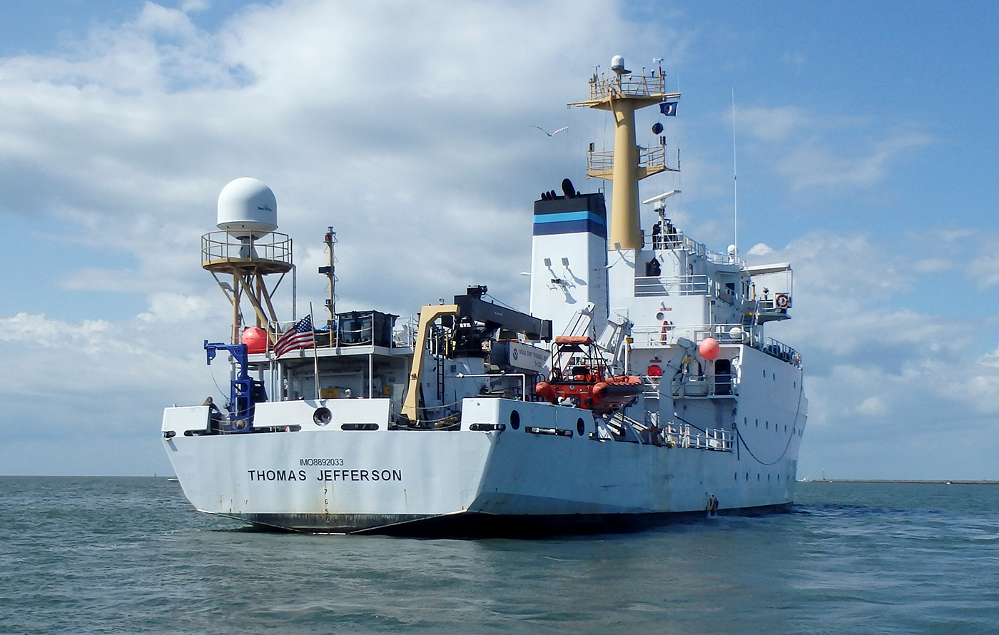
PHOTO COURTESY OF NOAA
The area on Lake Erie between Cleveland and Detroit as well as the Detroit River will soon be sonar mapped by the 208-foot Thomas Jefferson, a deep-water hydrographic survey vessel from the National Oceanic and Atmospheric Administration (NOAA).
Only 5 to 15% of the Great Lakes have been mapped to modern standards, and critical shipping channels within the Great Lakes rely on this information for safe navigation, reports the Windsor Star.
“Most of the charted data in the Great Lakes is older than 50 years,” says NOAA Commander Briana Welton Hillstrom, reports the Star. “We don’t have a lot of the source information that was used to make the current suite of navigation charts in the Great Lakes because it’s so old.”
The Thomas Jefferson will use multi-beam sonar to create 3D images of the lake bed while it surveys in a grid pattern looking for new underwater topography and features not already recognized on nautical charts. Surveying will focus on areas with heavy vessel traffic like Cleveland Harbor, South Bass Island and the Detroit River around Ambassador Bridge and the Windsor-Detroit International tunnel. Mapping data will be available from NOAA for public use by fisheries, resource managers and federal partners, and the progress of the project can be tracked on the ship’s Facebook page: NOAA Ship Thomas Jefferson.